
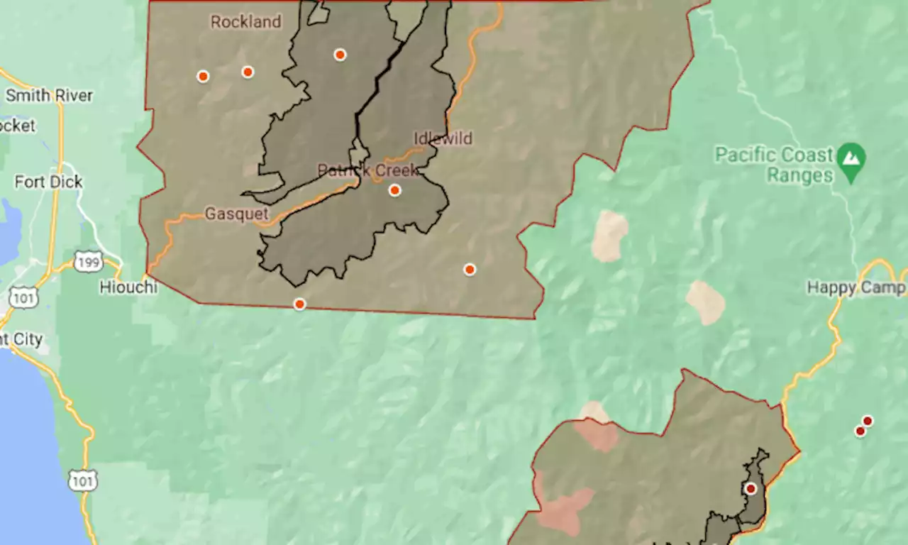
Twenty miles to the southeast, the Elliot and Swillup fires of the Happy Camp Complex merged over the weekend.
On Monday, they accounted for 7,877 acres of that complex’s 19,205 . Containment was 2% for the merged fire now called Elliot and 35% for the complex’s Head Fire, near Scott Bar.
The Smith River and Happy Camp fires started during lightning storms on Aug. 15-16. In the map above, the mandatory evacuation area is shown in red and the approximate perimeters of the largest fires in black. Colored dots indicate locations of smaller fires.Del Norte County. 70,716 acres ; almost all of that is the Kelly Fire, which merged with Holiday and crossed into Oregon.
Evacuation order: Gasquet and all other communities along Highway 199 from just east of Hiouchi to the Oregon line, plus residents in forested areas near the major fires. Power outage: Pacific Power de-energized transmission lines in the county in the early days of the fire. Power restoration has begun and was expected to be complete for customers in Crescent City, Smith River and Fort Dick by Friday, Aug. 25.
México Últimas Noticias, México Titulares
Similar News:También puedes leer noticias similares a ésta que hemos recopilado de otras fuentes de noticias.
 Map: Smith River wildfire reaches edge of Northern California townTwenty miles to the southeast, the Elliot and Swillup fires of the Happy Camp Complex merged over the weekend.
Leer más »
 It's official: Gov. Phil Murphy signs legislation to establish Central Jersey as a regionThe Garden State will redraw its tourism map to include and promote Central Jersey
Leer más »
 Russian Embassy Releases Map Recognizing Crimea as Ukraine's'Oh, Crimea is not Russia? Nice,' said one commenter of a post by a Russian embassy that showed a map with Crimea not included within Russia's borders.
Leer más »
 Tropical Storm Idalia evacuation map: Florida residents told to leaveCounties along Florida's Gulf Coast near Tampa Bay are calling on residents to evacuate from certain high-risk areas.
Leer más »
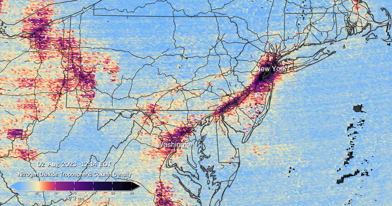 NASA releases first U.S. pollution map images from new instrument launched to space: 'Game-changing data'A spectrometer launched into orbit in the spring is collecting data on air pollution over North America.
Leer más »
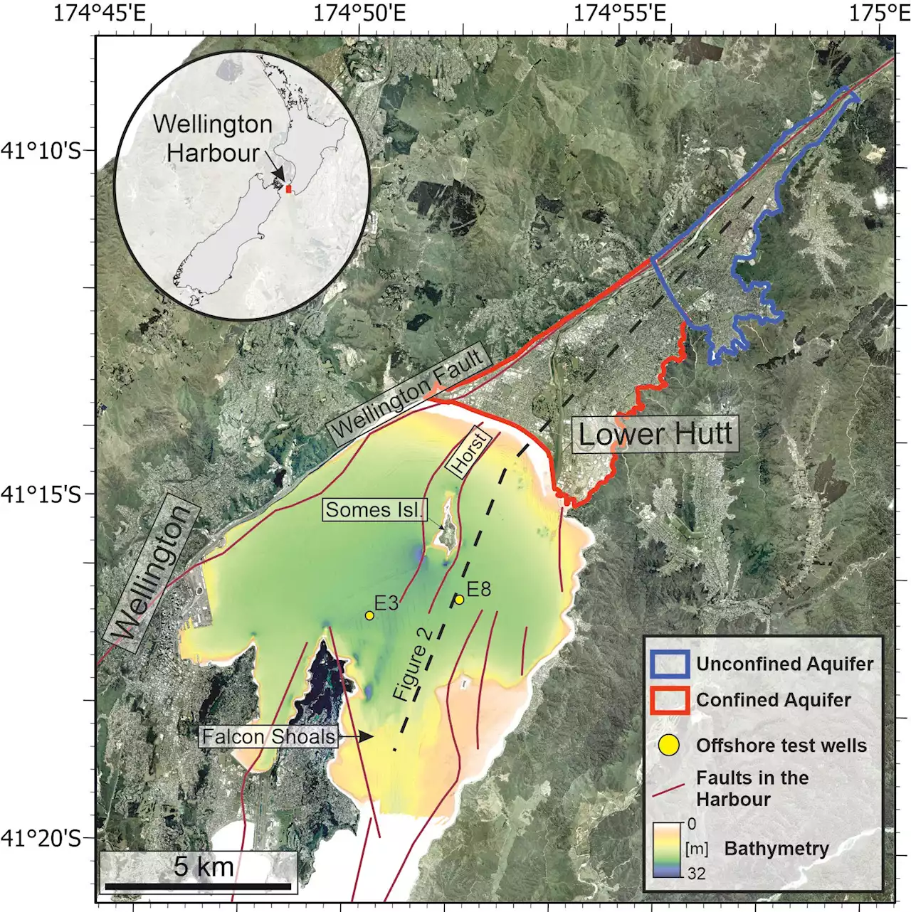 Researchers create detailed map of Waiwhetu Aquifer, technique could improve worldwide access to coastal freshwaterFor the first time, NIWA used several techniques to map and understand the Waiwhetu Aquifer. This is a reservoir of drinking water that lies beneath the Hutt Valley and Wellington Harbor, and it releases freshwater from deep under the seabed via natural springs.
Leer más »