
These maps from NASA are hot.
People relax underneath a blossoming tree during a warm spring day in Central Park in Manhattan.Thanks to a couple satellite images from NASA, we can see how cool it is to be green — literally. The maps below show that the greenest parts of the Northeastern US with the most lush vegetation have lower surface temperatures. Conversely, theThe map on the left depicts land surface temperatures across the Northeast US from June 21st to September 22nd, 2019.
NASA Earth Observatory images by Lauren Dauphin, using Landsat data from the U.S. Geological Survey and topographic data from the Shuttle Radar Topography Mission urban heat island effect. All the asphalt and big buildings in an urban jungle trap heat. As a result, cities tend to be several degrees hotter than surrounding areas. Within a city, more industrial areas tend to be even hotter. That tends to make heatwaves even
México Últimas Noticias, México Titulares
Similar News:También puedes leer noticias similares a ésta que hemos recopilado de otras fuentes de noticias.
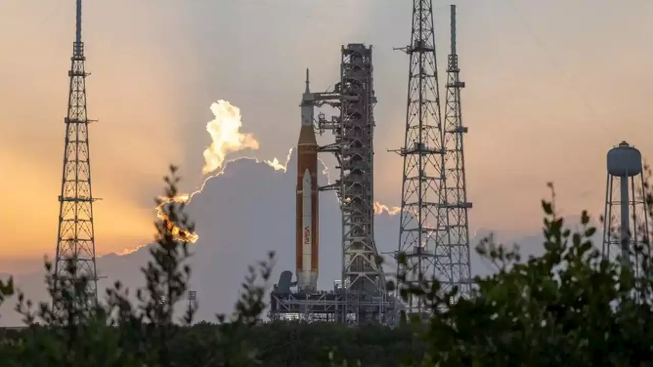 NASA moves ahead with Artemis I launch on Tuesday as Tropical Depression Nine moves toward FloridaAfter completing a fueling test of its mega moon rocket earlier this week, NASA engineers now have to contend with Tropical Depression Nine that appears to be aimed at Florida during the next launch attempt.
Leer más »
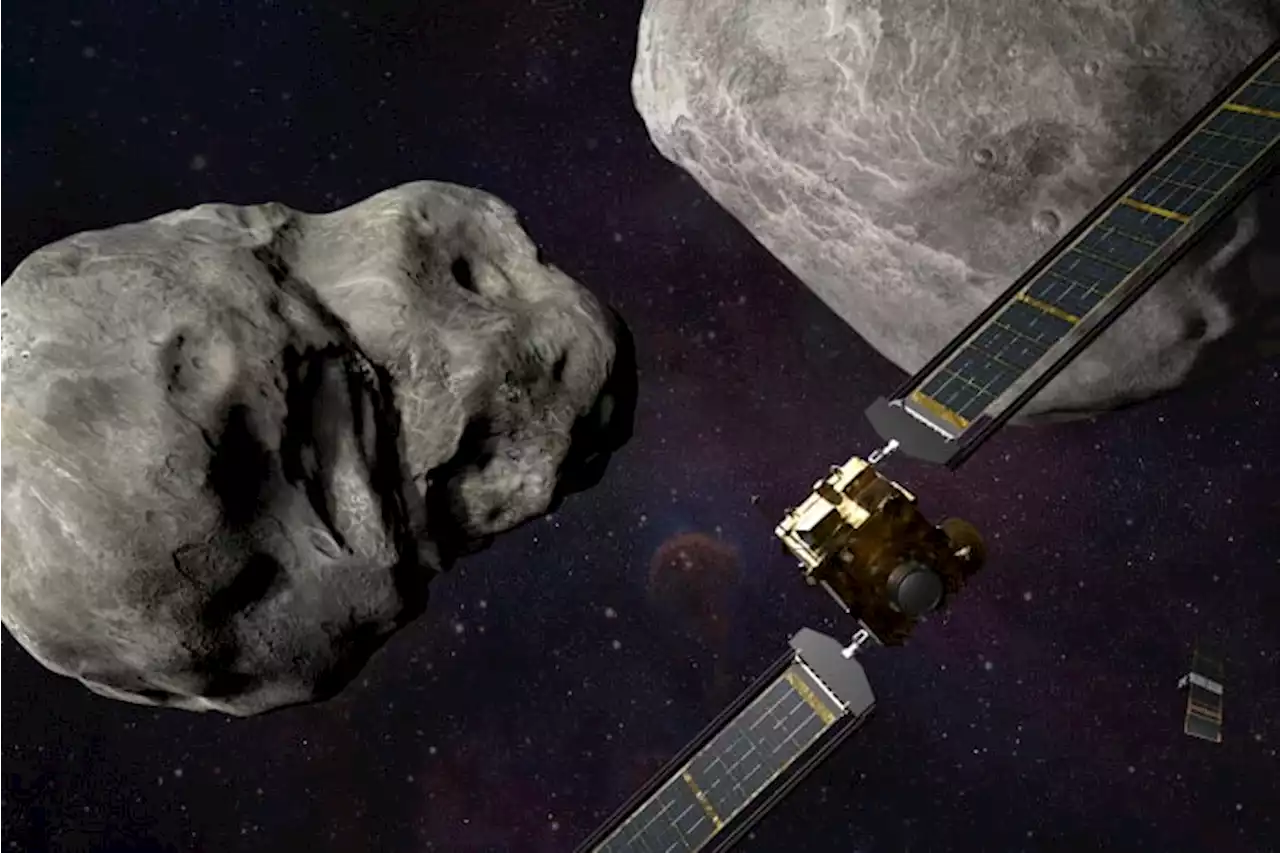 Why is a NASA spacecraft crashing into an asteroid?In the first-of-its kind, save-the-world experiment, NASA is about to clobber a small, harmless asteroid millions of miles away.
Leer más »
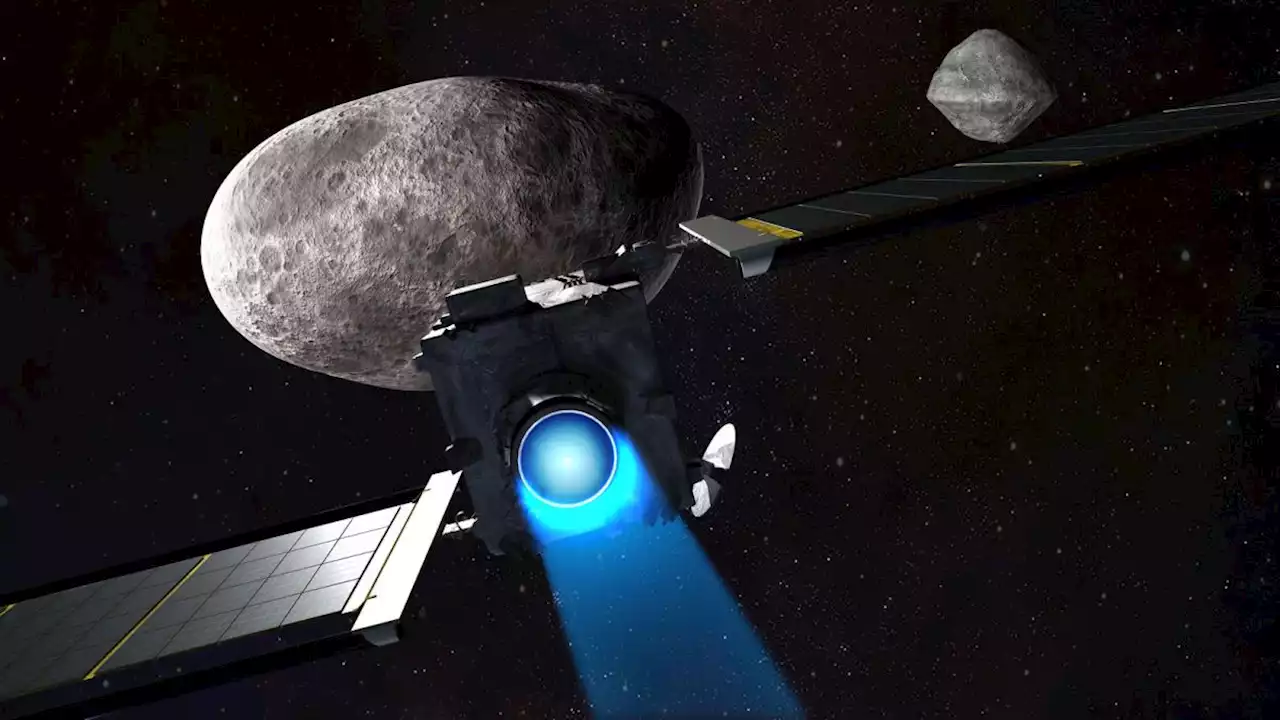 DART asteroid crash: What time will NASA probe hit Dimorphos on Sept. 26?NASA's DART spacecraft will crash into the asteroid Dimorphos on Sept. 26 at 7:14 p.m. EDT. Here's how the day will unfold.
Leer más »